Trails
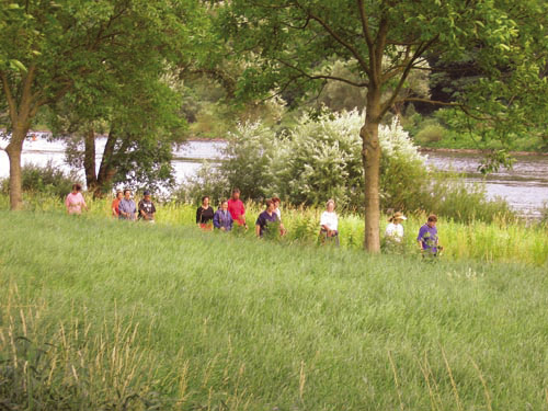
A large number of varied hiking trails around Ediger-Eller invite you to explore nature. They offer you unknown, charming insights into the beautiful Moselle landscape and the associated cultural treasures.

Wein- und Schmunzelpfad: (Size: 180 kB; Previous downloads: 9446; Latest download on the: 04.10.2025)
small circular hiking trail through the vineyards between Ediger and Eller with magnificent viewpoints into the Moselle valley.
Einsiedelei "Bruder Heinrich": (Size: 198 kB; Previous downloads: 7579; Latest download on the: 04.10.2025)
Hike through the nature reserve Taubengrün on the opposite side of the Moselle from Ediger-Eller to the hermitage "Bruder Heinrich".
Kulturweg der Religionen (Size: 105 kB; Previous downloads: 7008; Latest download on the: 04.10.2025)
Circular hiking trail, in Ediger starting to the Kreuzkapelle, back through the Pehrtal to Ediger.
Calmont-Klettersteig (Size: 198 kB; Previous downloads: 9139; Latest download on the: 04.10.2025)
Meditationsweg durch das "Pehrtal" (Size: 181 kB; Previous downloads: 7280; Latest download on the: 04.10.2025)
Wanderweg durch das "Brochemer Tal" (Size: 199 kB; Previous downloads: 5287; Latest download on the: 04.10.2025)
Wanderweg "Alter Postweg" (Size: 199 kB; Previous downloads: 6306; Latest download on the: 04.10.2025)
Wanderweg durch das "Reisental" (Size: 182 kB; Previous downloads: 5112; Latest download on the: 04.10.2025)
Wanderweg zu den Römergräbern (Size: 198 kB; Previous downloads: 5384; Latest download on the: 04.10.2025)
Wanderkarte Ediger-Eller (Size: 1.18 MB; Previous downloads: 9306; Latest download on the: 04.10.2025)
Various hiking maps and more detailed information on all hiking trails can be found in the
Tourist Information Mosel Calmont Region, 56814 Ediger-Eller,
Phone: 49(0)2675-1344, E-Mail: info@ediger-eller.de
This article is already 116397 Once seen.


